
If you’re looking for information about Comer Channel in The Bahamas, this post might have what you’re looking for. This year (2022) was the first time we ventured into the Jumentos Cays and Ragged Islands. We took Comer Channel from Thompson Bay, Long Island, to Water Cay. Here is an overview of the route we planned and tool in TimeZero:
Here are two GPX files. One is of the planned route and the other of the actual track — they are essentially the same.
Planned Route (Download GPX approx. 1KB)
Recorded Track (Download GPX approx. 3MB)
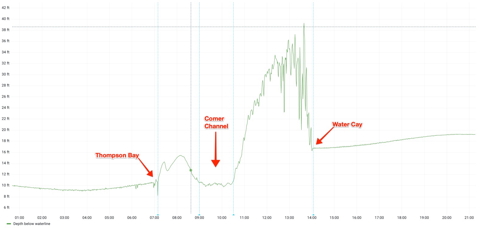
We timed Comer Channel for high tide and used Nassau tides +1-1/2 hours. Here is a graph showing the depths of our voyage:
Unable to download GPX file of the route.
Hi Peyton, what’s going on? I just tested downloading the files in an incognito window and they both downloaded fine. What browser are you using? What happens when you click on the links?
Hello, nice trip !! We are in Georgetown and we want to go to Ragged Island. Our draft is 6.9.
Do you know if Comer Channel is depth enough for us?
Sorry for the late reply. The Comer Channel should be okay for you, just make sure to go at high tide and stay on the suggested Explorer Charts route.